Burn danger not over. Fire watch issued for Tri-Cities region as temps climb
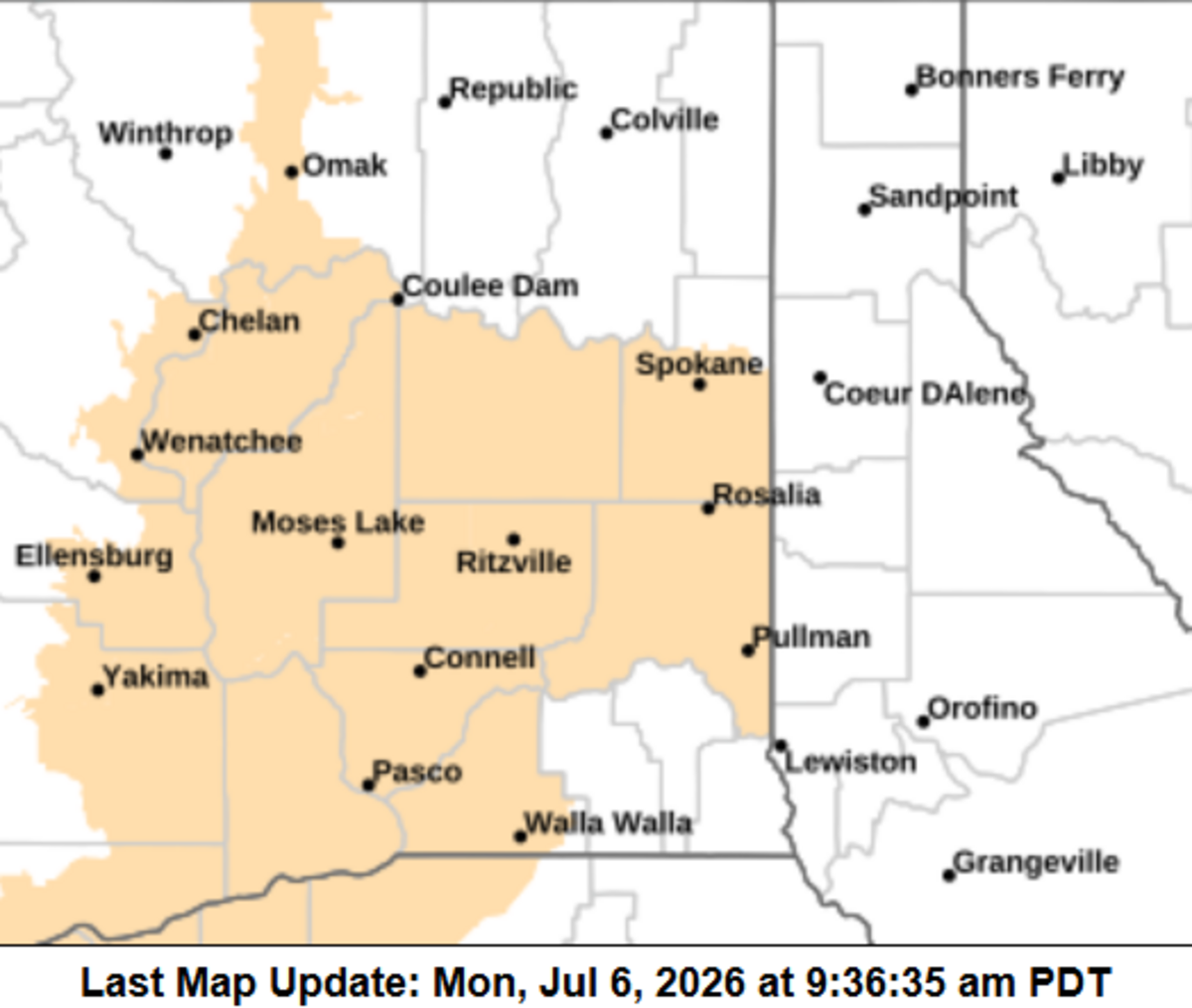
The National Weather Service has issued a fire weather watch for Tuesday as the Tri-Cities looks for a hot week ahead.
The fire weather watch includes the Mid-Columbia and extends south through north central Oregon and as far north as the Canadian border from 11 a.m. to 10 p.m. Tuesday.
Low humidity and breezy winds are expected to contribute to critical fire weather, with any flames spreading rapidly, according to the weather service. Gusts of up to 20 mph are expected starting Tuesday evening in the Tri-Cities.
Tuesday is predicted to be the hottest day of the week, with a high forecast at 98. The hottest temperature recorded so far this year was 97 on June 15, according to weather service data.
Normal Tri-Cities highs for this time in July are about 90 degrees, and after Tuesday highs should be within a few degrees of that through the coming weekend.
Sunny daytime skies are forecast.